OH BABY IT’S A WANDERFUL LIFE PART IV // KATSCHBERG

To all real summit strikers, hiking women, and those who have been bitten by the wanderlust or mountain nostalgia – On your feet, get set – go!!! This year Part 4 of our hiking series leads us again to Carinthia, this time to the Katschberg. Strictly speaking, this lies exactly on the border between the Lungau in Salzburg Land and the Katschtal in Carinthia. Today we present 4 hiking routes that real hiking enthusiasts should not miss!

1 // HIKE INTO THE GONTAL NATURE RESERVE

The hiking trail starts at the Katschberg Tourist Office, from there you continue along with trail number 20, through the hotel village. Once you have crossed two tunnels, you will eventually find yourself on a forest path. This leads to the Pritzhütte and the beautiful nature reserve Gontal, where you can admire the untouched nature. For the way back you have the choice: Either you can take the same way back or book a horse-drawn carriage. And for those who like to take a little break during a hike to have a good snack, the Pritzhütte in Gon Valley is the perfect place. The cozy alpine hut offers a rustic atmosphere and is an experience for all ages. If you like, you can enjoy local specialties there as a stopover during a long hike.
For children interested in horses, this hike offers not only the Pritzhütte, where you can recharge your batteries, but also the Ponyalm, where you can ride ponies. But also learn a lot about the care of horses. While the children get to know the animals, the parents can relax on the sun terrace. But the horse center offers not only fun for children, but there are also carriage rides and trail rides.
If you still haven’t had enough of this trail, you can extend the route to the Stöckelalm and enjoy the beautiful nature for even longer. Tourfacts: easy // 7,5 km // 218hm // 2:00 h
@katschberg.at

2 // THE HERZERLRUNDE TO GAMSKOGELHÜTTE

This hiking route is perfect for a family undertaking because the hike leads to the Gamskogelhütte, where there is a lot to discover. By the way, the hut is also easy to reach with strollers, thanks to the wide forest path. The Gamskogelhütte offers in summer and in winter the perfect opportunity for a break to enjoy a snack or to be amazed by the view.
The route starts at the tourist office Katschberg, then you take a left ascending path. Important: this time it does not go through the tunnels! If you pass above the hut village, you will soon see trail number 19 marked. If you stay on the Herzerlweg, you will first pass the Marienkapelle chapel and then encounter the Gamskogelhütte hut with adjacent children’s playground. From there you hike along the toboggan run. This begins below the hut, where it continues to an asphalt road. If you turn right here, you will come back to where you started. Tourfacts: medium // 3,9km // 192hm // 01:26 h

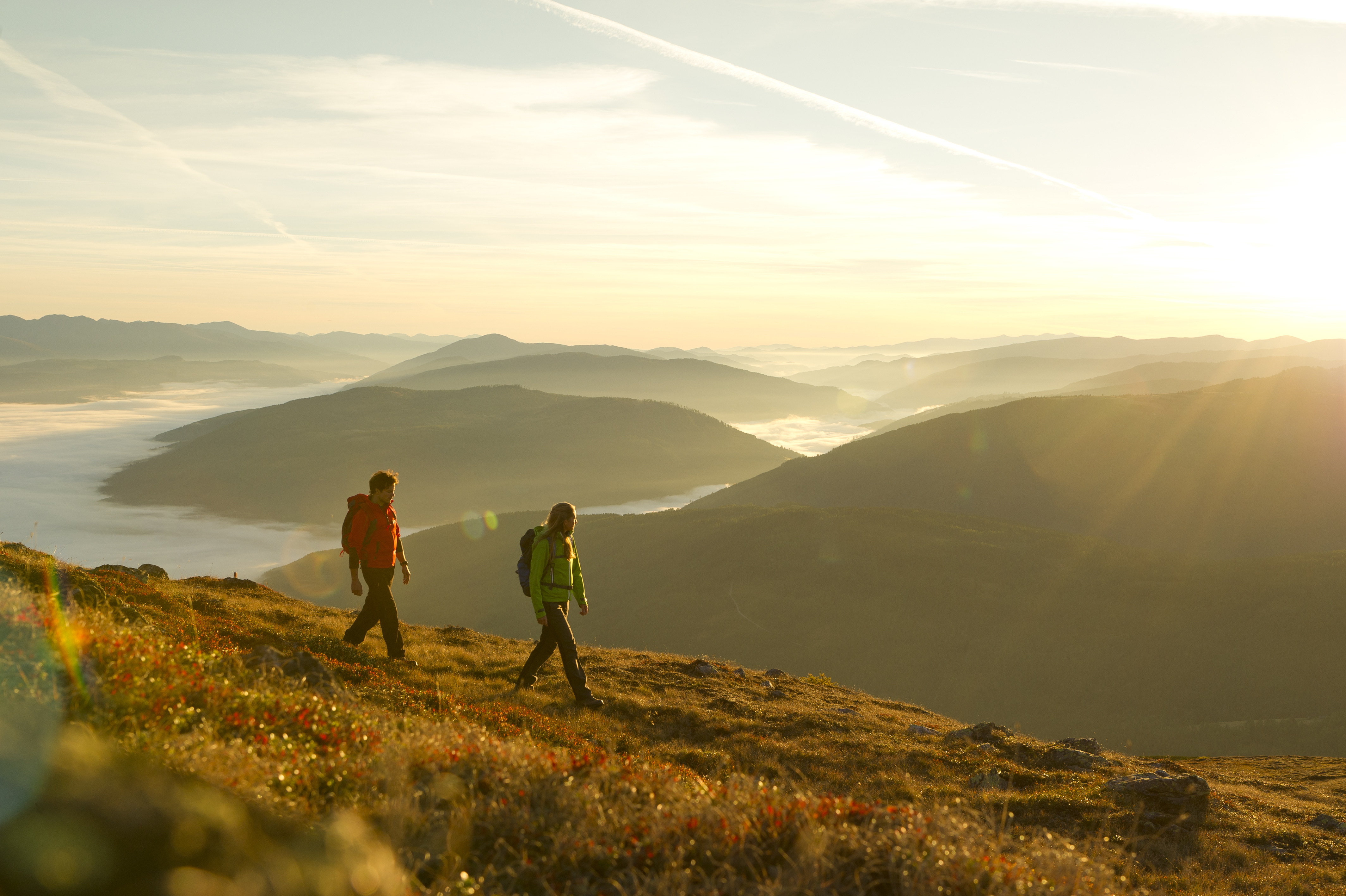
3 // MOUNTAIN TOUR ON THE KARECK

If you want a real challenge, you should consider this hiking trail, because it requires stamina. But once you have made the ascent, you will be rewarded with a fantastic view. This trail also leads you first to the Pritzhütte, from there it’s on across the meadows up to the summit. Important to know: There is no real hiking trail here anymore! But don’t worry, there is a visible path that has been used. You can hardly get lost. Arrived at the summit cross you can enjoy a wonderful view over the landscape. Here it is easy to just let your soul dangle and just marvel at nature, far away from any everyday stress. Tourfacts: difficult // 13,78km // 832hm // 5:10 h
©TVB Rennweg/Katschberg

4 // BIG ROUND HIKE

A circular hike from the Falkensteiner Resort Katschberg to the Branntweiner-/Kösselbacheralm via the Aineck and back to the Katschberghöhe. Also a tour for all those for whom a good view is important during a hike. But it is also ideally suited for Nordic walking.
The hiking trail starts at the ice bar at the Falkensteiner Club Funimation Katschberg and from there you turn right in the direction of the Aineck piste and there you follow the footbridge on the left. Continue on this path until you reach a crossroads on the forest road. Here you turn right and follow the signs with the numbers A and B. From there you walk on the right. From there you walk about 1 ½ hours to the Branntweiner-/Kösselbacheralm and from there you turn right up the hiking trail C to the Aineck. To get back home, take trail number 111 down until you reach your starting point again.
For those who want to take it a bit easier, this tour can also be done the other way around and use the chairlift for the ascent to the Aineck. Tourfacts: medium // ~12km // 671hm // 04:31 h If you’re now in the mood for hiking, you should definitely download the Falkensteiner Katschberg app and find out more about all the possible hiking routes on the practical maps.

Tauche ein und finde...

Dive in and find...