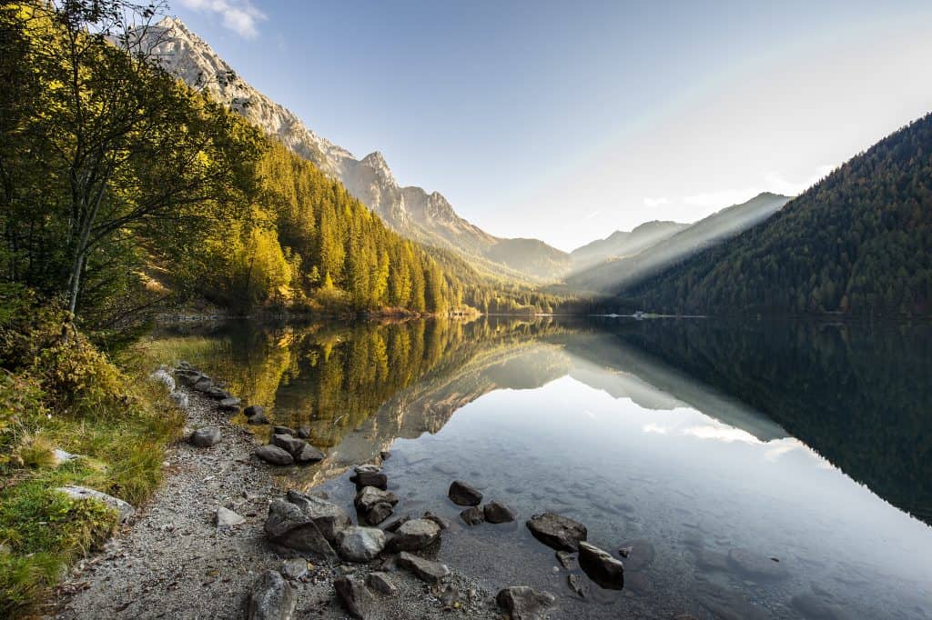
When my gaze slowly drifts down the endless distances to the valley, this is “pure magic” for me every time. The luscious green of the meadows with their flowers as colourful and playful accents. The mystical forests with their impressive treetops. And the bright turquoise blue mountain lakes, where the majestic mountain peaks are reflected in the surface of the water. – Simply beautiful.
Part II of our multi-part hiking series takes us to the northernmost province of Italy – South Tyrol. The unique mixture of alpine terrain and Mediterranean flair makes the region a very special holiday destination. Today, we’ll show you three impressive hikes in the South Tyrolean mountains.
1 // FANE ALM TO WILDEN SEE & TO WILDE KREUZSPITZ CIRCULAR TRAIL
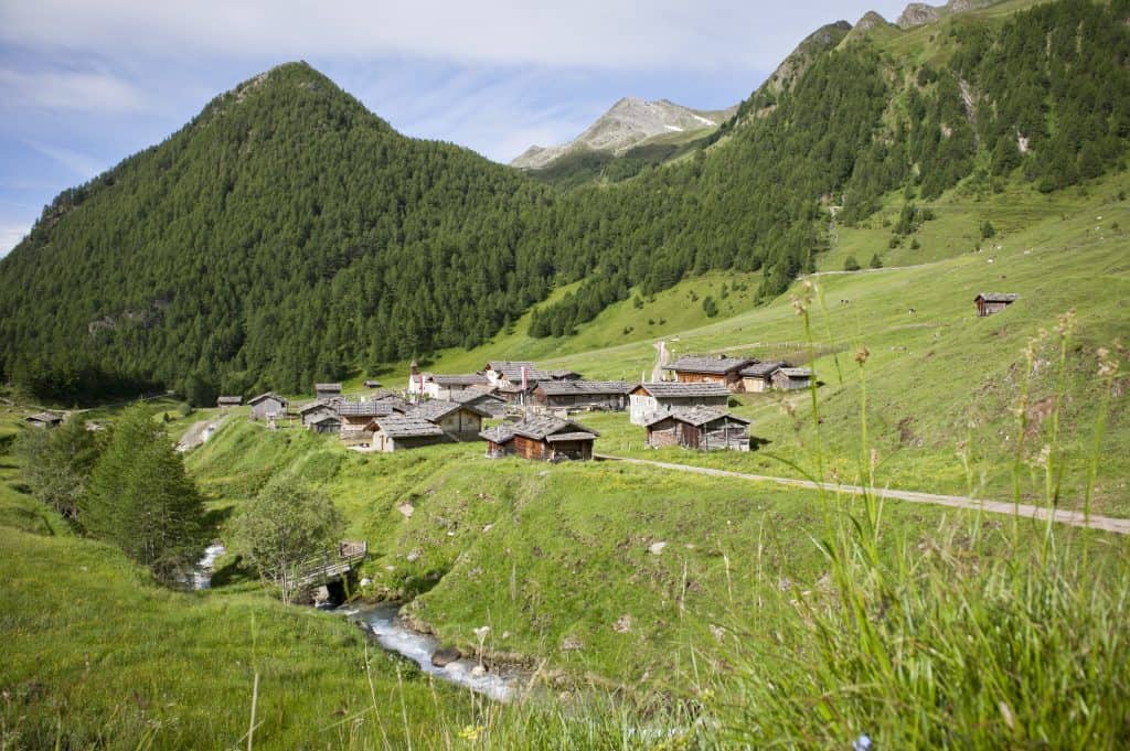
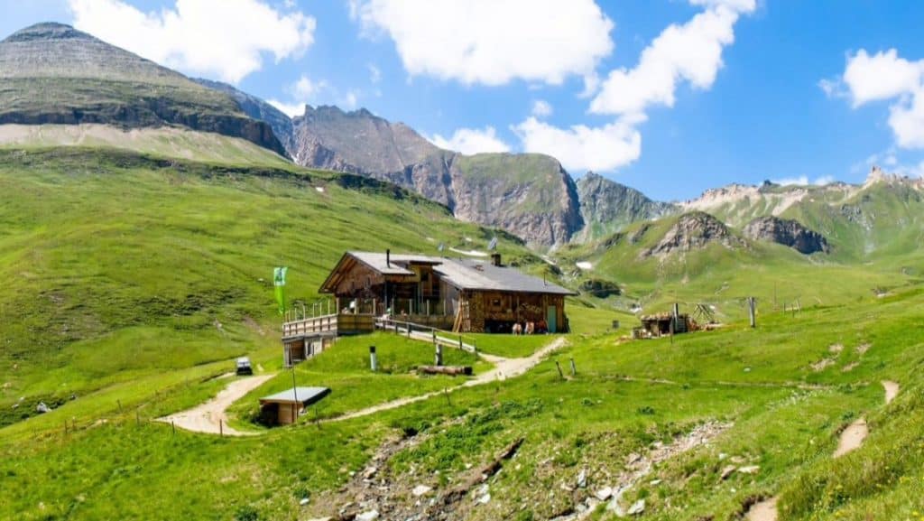
In the middle of the Gitschberg-Jochtal region, in the Puster Valley, is probably the most beautiful alpine village in South Tyrol, Fane Alm. This idyllic alpine village is not only a popular destination for a family outing but also the starting point for a variety of exciting mountain hikes. It’s important to choose the hike that corresponds to your age and level of fitness.
A very popular route is the Fane Alm – Wilder See – Wilde Kreuzspitze – Brixner Hütte – Fane Alm circular route.
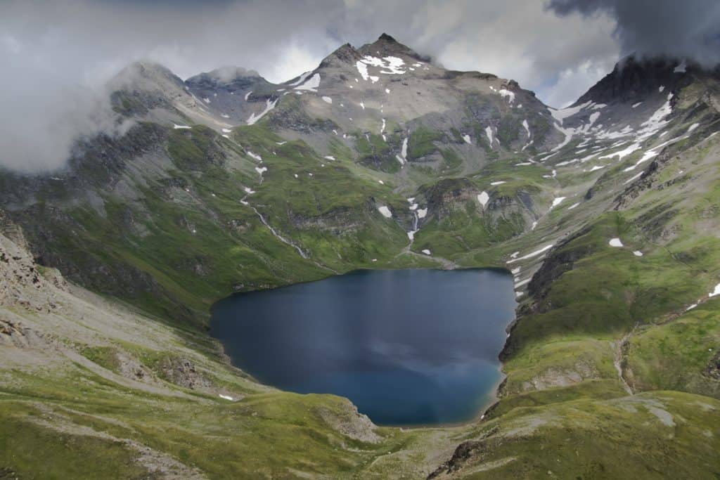
From the alpine village, follow trail no. 17 on the left side of the hill, through the Schramme gorge. Shortly after the gorge, follow the alpine trail to the left with marking no. 18 westwards to the Labesebenalm (2,138 m). From there, you will overcome the ascent in a wide loop and reach the Wilden See (2,532 m). Trail no. 18 runs right, east of the lake, rising to the Rauhtaljoch at 2,807 m. Once at the Joch, follow the alpine trail no. 18, which leads across the southern slope in turns to a hillside terrace and left on the ridge to the summit of the Wilden Kreuzspitze (3,132 m).
After a long summit rest, you descend again to the Rauhtaljoch. There, a trail goes leftover rocky terrain or snowfields in a northern direction down to the grassy area of a high valley. The trail now leads east to the Brixner Hut (2,282 m). The descent is via the Hüttenweg (Hut trail) (marking no. 17) out of the valley through the Schramme gorge to the starting point of Fane Alm.
https://www.youtube.com/watch?v=6_Q7_0oxSLk
For all those who prefer to get information about the hike by video: Our Falkensteiner video blogger Michael Gruber has already done it and describes his impressions in the 3rd episode of “A local heartbeat”.
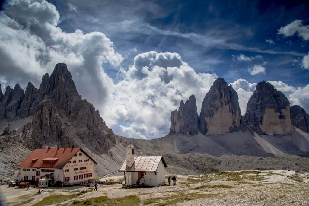
2 // SUMMER TOUR: THE THREE PEAKS
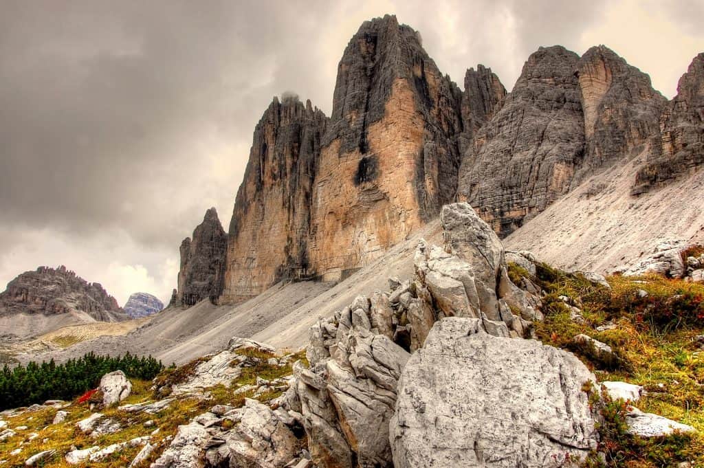
The next hike leads us to one of the most well-photographed sights in South Tyrol. We are talking about the Three Peaks in Alta Pusteria. In 2009, they were added to the UNESCO World Heritage list with other Dolomite peaks. In other words a real must for enthusiastic hikers to circumnavigate and see for themselves this impressive South Tyrolean landmark.
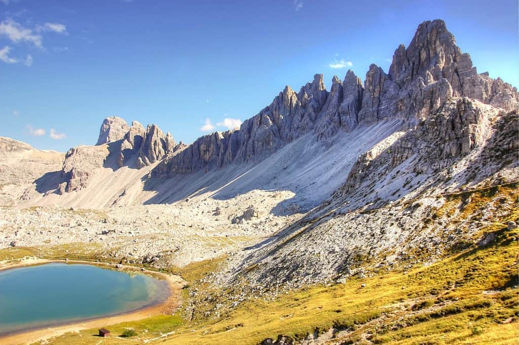
The starting point of the Three Peaks circumnavigation is the Auronzo hut at 2,320 m. To get there, drive to Dobbiaco, then through the Hölensteintal towards Dürrensee or Misurina. You can also make a short stopover at the two lakes and enjoy the local natural scenery while taking some cool hiking photos. If you stop by Dürrensee, you will have a wonderful view of the Paternkofel, the Monte Piano and our ultimate destination, the Three Peaks.
The Auronzo hut is where the circular hike starts. First, follow trail no. 101 in the direction of the Lavaredo hut past a small church and continue up to Paternsattel. Here, at 2,454 m, you can see the 500 m high north face of the majestic Three Peaks. The Little Peak (2,857 m), the Great Peak (2,998 m) and the Western Peak (2,973 m). From there it goes slightly downhill. We walk directly at the foot of the Paternkofel. After some time we come to a fork in the road. Here you could continue to the Three Peaks hut or take the descending path no. 105 at the Lange Alpe mountain hut and complete the orbit around the Three Peaks.
You will find more information about the hike and a few more hikes to enjoy here.
Tour facts: easy // 8.8 km // 550 hm // 04:00 h // family-friendly
If you want something more challenging or you are an experienced mountaineer, you are welcome to make the mountain hike from the Fischleintal valley to the Three Peaks hut and explore the Sexten Dolomites. From Schusterplatte you have a wonderful view of the Dreischusterspitze in front of you.
Tour facts: difficult // 15.3 km // 1000 hm // 06:15 h // experienced mountaineers
3 // RIESERFERNER-AHRN NATURE PARK
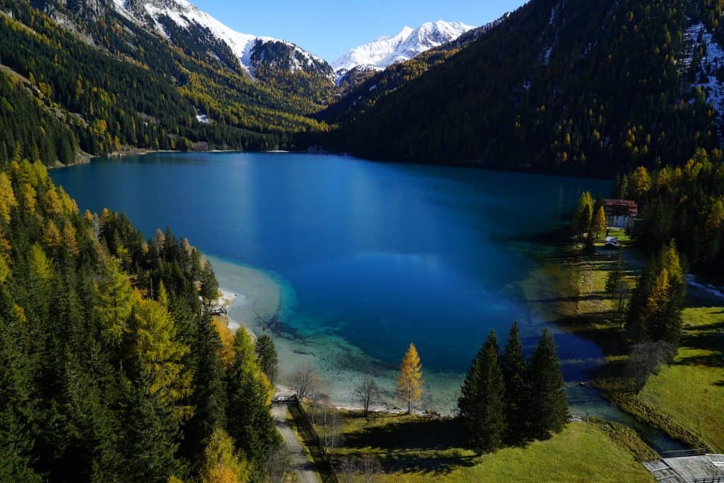
Antholz has long been a household name for biathlon enthusiasts – by 2020, Antholz will become a special hot spot for biathletes, as the coming World Cup will be held there. But far away from winter sports, the local area also offers some highlights in summer, such as the Rieserferner-Ahrn nature park. It also has a large selection of walks. From leisurely hikers to advanced alpinists, there really is something for everyone.
This not only offers the highest glaciated areas of the South Tyrolean nature parks, but also a variety of natural jewels and hiking trails. A very special place is the deep green Lake Antholz in the Antholz Valley. For families, the lake offers a cosy nature trail with a total of 16 stations that inform about the characteristics of the lake and the local nature. You can even push a buggy over this easily.
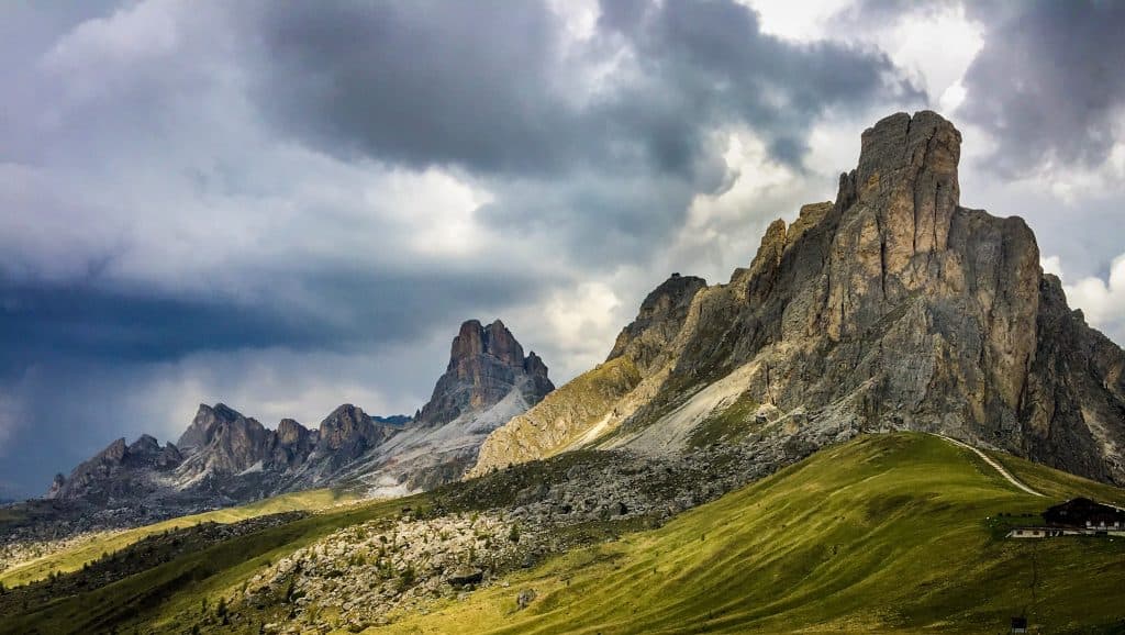
Now for the last mountain tour in the Antholz Valley. This leads us to the red wall. The starting point of the tour is the Staller Sattel at 2,052 m. The journey is easily possible by car and even leads past the Antholzer Lake, where you can make a short stopover. The mountain pass road to the Staller Sattel alone is a particular eye-catcher in the autumn season. From the car park of the border crossing, follow trail no. 7 in the direction of the Rote Wand. The trail is well marked and in a pleasant slope
Once at the top you have a fantastic view over the glaciers of the Zillertal Alps, the Rieserferner Group to the Großglockner and the Sextner. It also has a magnificent view of Lake Antholz surrounded by the Wildgall and Hochgall mountains.
If at some point you feel like you’ve seen enough of the mountain panorama, you can head back the same way.
Tour facts: moderate/easy // 6.0 km in each direction // 03:00 h
“So, dear hikers”, these were the three “must-do’s” for a holiday in the South Tyrolean mountains. If you still want to be inspired by the South Tyrolean natural jewels, then you must take a look at the 360° Tour classics, such as the Three Peaks, Lake Antholz and Lake Braies which can be explored with a click of the mouse.